Abstract
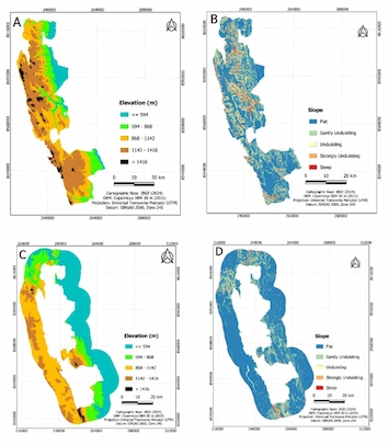
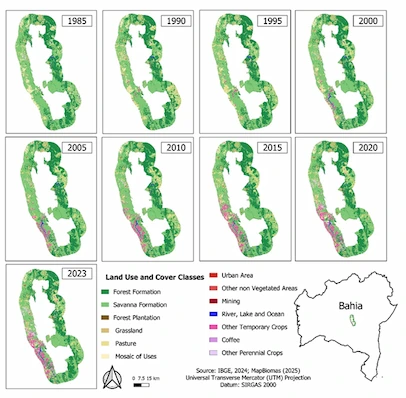
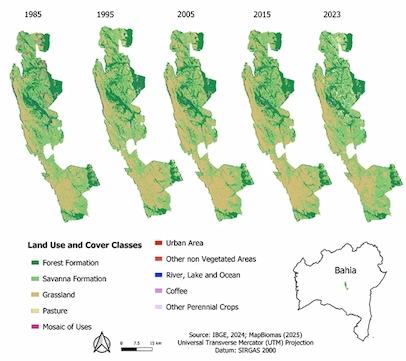
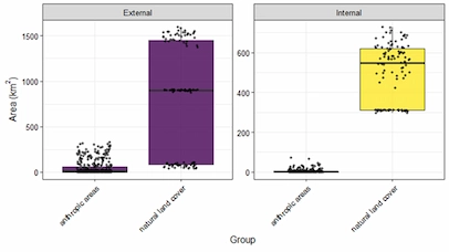
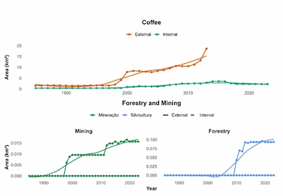
This study aimed to analyze, in a multitemporal approach, the changes in land use and land cover within the Chapada Diamantina National Park (PARNA-CD), located in the state of Bahia, Brazil, and its buffer zone between the years 1985 and 2023. The research utilized data from Collection 9.0 of the MapBiomas Project, processed through Google Earth Engine (GEE), based on 30-meter resolution Landsat imagery, applying remote sensing techniques and statistical analysis to identify spatial and temporal trends. The results showed that the internal area of PARNA-CD remained environmentally stable over the study period, with minimal land cover changes, with the predominance of natural vegetation formations and low anthropic occupation. In contrast, the buffer zone experienced an intensification of human activities, particularly the significant growth of silviculture, with an annual rate of 10.3%, and mining, with approximately 6.5% per year, in addition to urban and agricultural expansion. Downward trends were observed in the savanna formation and mosaic of uses classes, indicating changes in landscape patterns. The comparative analysis confirmed the effectiveness of the conservation unit as a barrier against the expansion of anthropic land uses and underscored its importance in preserving biodiversity and vegetation cover. However, land use and occupation processes in the surrounding areas require attention and integration into planning strategies aimed at regional-scale environmental conservation.
Article details
- Volume
- 15
- Number
- e025283
- Received
- 2025-08-02
- Accepted
- 2025-10-28
- Published
- 2025-10-30
Figures